The Prestonpans Area
| < Gullane / Aberlady | Δ Index | Edinburgh > |
A discontinuous defence line was built inland from Prestongrange. At the coast, the eastern wall and half the length of the southern park walls of Prestongrange House were prepared for defence, a length of about 860m from NT 3791 7408 to NT 3791 7341.
The wall is now above head height, but shows signs of having been raised from waist height. The eastern side was fronted by a barbed wire entanglement. These firing positions covered the minor road along the coast (to the north), and the more significant road from Preston towards Edinburgh.
Firing positions were placed beside the main A1 road, just west of Tranent, and a 430m long barbed wire entanglement ran south from the road, at Dolphingston Toll (NT 3754 7270 to NT 3777 7232).
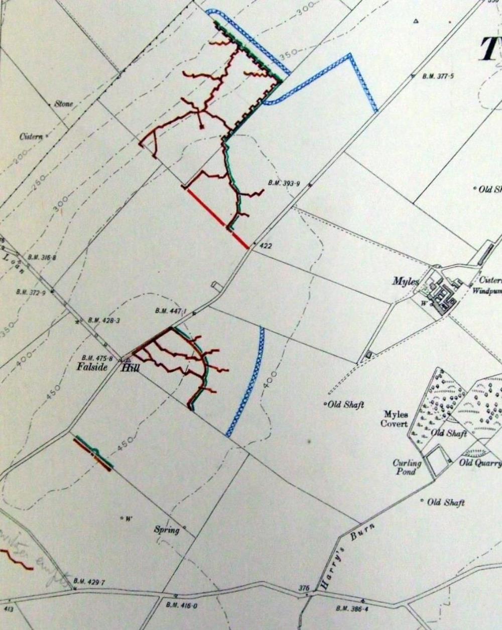
The most heavily defended road was what is now an unclassified road running south-west from Tranent towards Falside Castle, along the ridge of Falside Hill, which commands the coastal plain to the north. Very extensive and complex firing positions, with equally complex communications trenches, were constructed to the north (at NT 3844 7201) and south of the road, the southern positions being set about 260m further west (at NT 3832 7136). Two further backup firing positions were situated 250m and 650m further south-west. The western was labelled on the map as ‘Howitzer empts’ [emplacements] at NT 3789 7081.
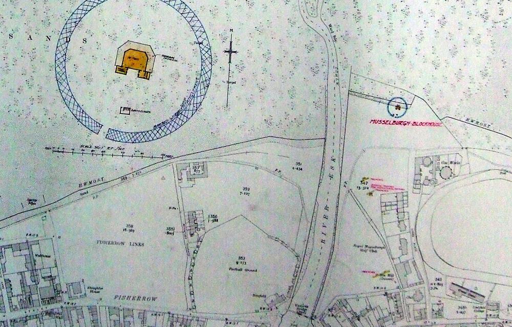
Two blockhouses on this stretch of coast, at Musselburgh and Westpans, were recorded in May 1916 (WO 78/4396 1916). The mouth of the River Esk at Musselburgh was guarded by a blockhouse, which was no more than a simple timber hut with a shallow pent roof, and made bulletproof by an embankment of sandbags on its vulnerable sides. The file (ibid) contains a 1:10,560 map showing the location of the blockhouse and, as an inset, a larger scale plan (Illus 30); a different map has an inset of a cross-section.
 Cross-section of the Musselburgh blockhouse.
The southernmost element of the defence comprised infantry positions 480m west of Elphinstone Tower, south of what is now the B6414 road, from Tranent to Dalkeith (at NT 3855 6979).
 The east-facing defences on Falside Hill, east of Edinburgh
 1:10,560 map showing the location of the Musselburgh blockhouse and, inset to the left, a larger-scale plan.
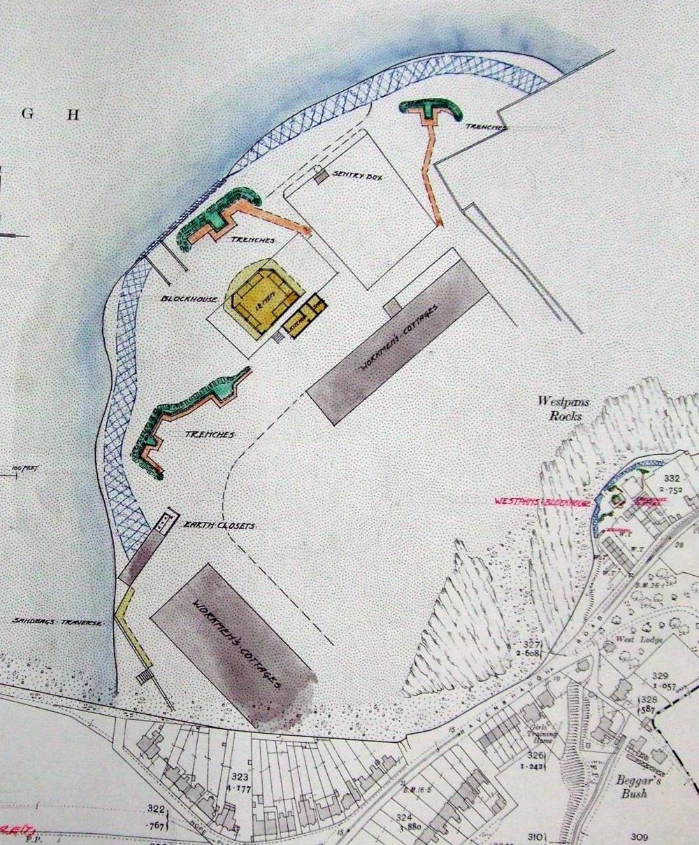
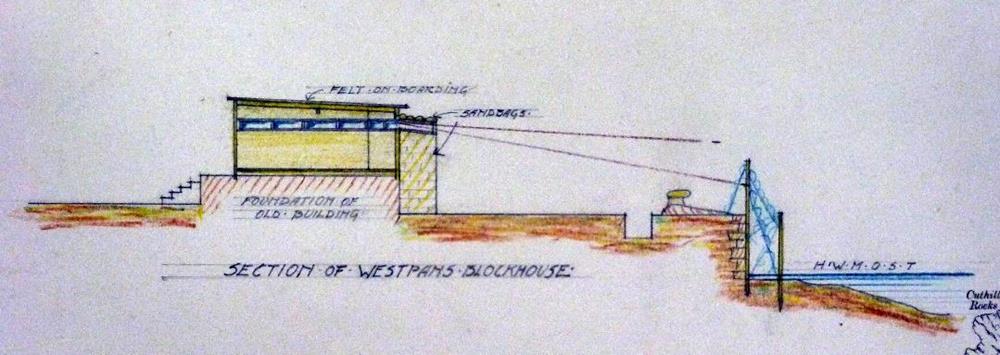
The Westpans defences were more complex. Once again, the blockhouse was a simple wooden hut with sandbags built around it, except at the rear. It had beds for 12 men and they were provided with a separate cookhouse and store behind the blockhouse. There were three firing trenches to the west, north-west and north-east of the blockhouse, and a sentry box, all fronted by a barbed wire entanglement along the top of the beach. Earth closets for the garrison were located at the south-west edge of the complex. A larger-scale plan and cross-section were also provided.
 1:10,560 map showing, in the right and bottom edges, the location of the Westpans blockhouse and its associated firing trenches and service buildings. Most of the image is occupied by a larger-scale inset showing more detail of the complex
 Cross-section of the Westpans blockhouse and the firing trench in front of it.
| < Gullane / Aberlady | Δ Index | Edinburgh > |
top of page
