Forth Bridge – Northern Approaches
| < RNAD Crombie and Rosyth | Δ Index | Forth Bridge – Southern Approaches > |
Until the Kincardine Bridge was opened in 1936, the lowest road crossing of the Forth was at Stirling. The Forth rail bridge was, however, regarded as a potential route for enemy infantry, cavalry and artillery to cross the estuary, as a route to transport British troops. For this reason, and because it was feared that the bridge could be brought down to block the channel, it was defended during much of the period under consideration.
In the 1900 defence scheme, an attack on the Forth Bridge from the north was ‘not considered probable’, and the possibility of an attack from the south was not even mentioned. By the 1905 defence scheme both ends of the bridge were to be guarded by detachments each of one officer and 30 other ranks, from the battery guards at Dalmeny and Carlingnose. Any railway rolling stock was to be moved some distance inland, to avoid it being used by the enemy to cross the bridge.
In the 1907 defence scheme an infantry reserve battalion was to be stationed at Carlingnose, which would take care of the security of the northern end of the bridge and the two coast batteries. The security of the southern end of the bridge was to be managed solely by the company-strength infantry garrison of Dalmeny battery (WO 33/444 1907).
By 1909 the defence of the north end of the bridge was to be fully integrated into the defence of Carlingnose and Coastguard batteries. A single company of infantry was allocated to this task with a section-sized detachment on Inchgarvie, tasked specifically with observing the piers of the bridge. The scheme specifically stated that ‘the most important positions are those covering the north end of the Forth Bridge and the works at Rosyth. They must be held at all costs …’.
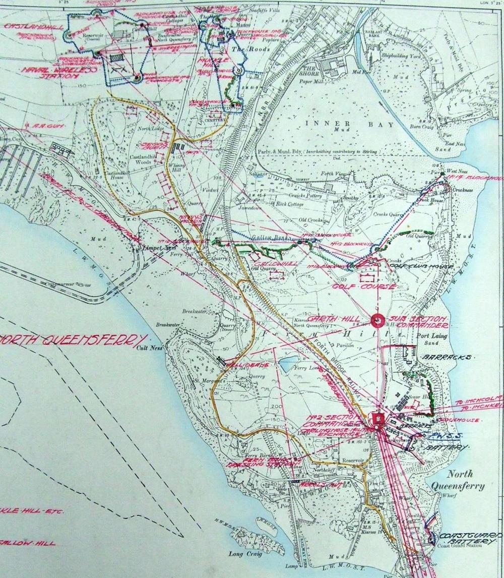
The northern end of the Forth Bridge lands on a broad peninsula, on which the Coastguard and Carlingnose batteries were also sited. In the First World War, both batteries were provided with close defence – firing trenches; barbed wire entanglements facing the coast and inland. The northern end of the peninsula was closed off by a complex line of firing trenches, along which there were five blockhouses (numbers 10 to 14 in the overall scheme), fronted by barbed wire entanglements. The western end of the line lay at NT 1244 8168, the eastern at the foot of the pier at Crookness (NT 1354 8201). The western end of the line covered the road and rail approaches to the bridge.
To the north an additional line of defence was provided, to the west of the main road, by the heavily defended perimeter of the Castlandhill Naval Radio Station, which included five blockhouses. Three were made of concrete and survive: at the south-east corner of the site (NT 18 SW 222.01: NT 12058 82551); at the north-east (NT18SW 222.02: NT 12095 82742); and at the west side (NT18SW 222.03: NT 11905 82635) – now very heavily overgrown).
 Map showing the complex defences of the northern approaches to the Forth Bridge integrated with those of the Castlandhill Naval Wireless Station
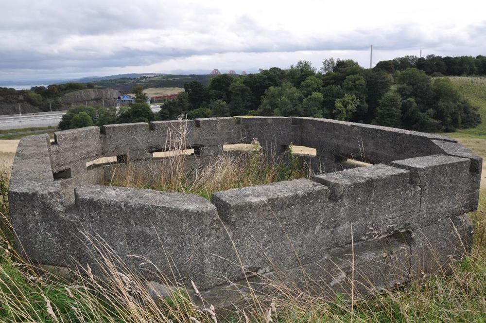
The north-east and south-east blockhouses are both about 5m square, with chamfered corners and 12 loopholes (four on the sides and eight on the corners). Entrance was gained by means of a low doorway below a loophole (its top just visible slightly right of centre on Illus 23). The blockhouses were not provided with concrete roofs – instead they seem to have had timber roofs supported on six beams, for which slots were provided in the wall-tops.
 The south-eastern blockhouse at the Castlandhill Naval Radio Station, from the north-west.
Immediately to the east of the main road there was a strong redoubt with four further blockhouses, effectively controlling access to the south; the redoubt was extended for about 350m to the south, where firing trenches and two further blockhouses covered the site of a possible landing in Inverkeithing’s Inner Bay.
| < RNAD Crombie and Rosyth | Δ Index | Forth Bridge – Southern Approaches > |
top of page
