Gullane / Aberlady
| < Dunbar | Δ Index | Prestonpans > |
The defences at Gullane covered the beaches to the north of the town and the beaches forming the east side of Aberlady Bay. These were defended again in 1940–1.
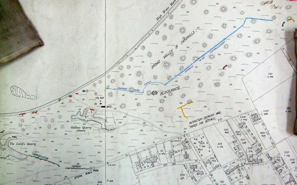
 The defences north of the village of Gullane showing existing parapets and trenches and ‘proposed additions’, in yellow.
Covering the north of the town was a blockhouse with a wire fence to its north and west, and a barbed wire entanglement to the north-east.
In the same area trenches are marked as ‘instruction trenches not suited for defence’.
A stone wall to the north-west of the town was marked in such a way as to imply that it was to be used as a firing position.
To the west of the blockhouse was a series of nine firing trenches, one at the Gullane Quarry, three at the Laird’s Quarry (linked by a communication trench to a stone wall), and five just above the beach. Two huts were marked, probably to accommodate the garrison.
Covering the east shore of Aberlady Bay were four widely spaced firing trenches overlooking the north-west corner of the dune system (as well as three further ‘Instruction trenches’, not illustrated).
The ‘Aberlady Group’ of defences comprised two lengths of barbed wire fence and entanglement running west to east, inwards from the coast. About nine firing trenches were positioned behind and between them, facing out to sea, with another group of three huts, probably for the garrison.
| < Dunbar | Δ Index | Prestonpans > |
top of page
