20 – Land reclamation, excavation and dredging
| < 19 – Secondary floating caisson for the Emergency Opening | Δ Index | 21 – The Oil Storage Tank Farm > |
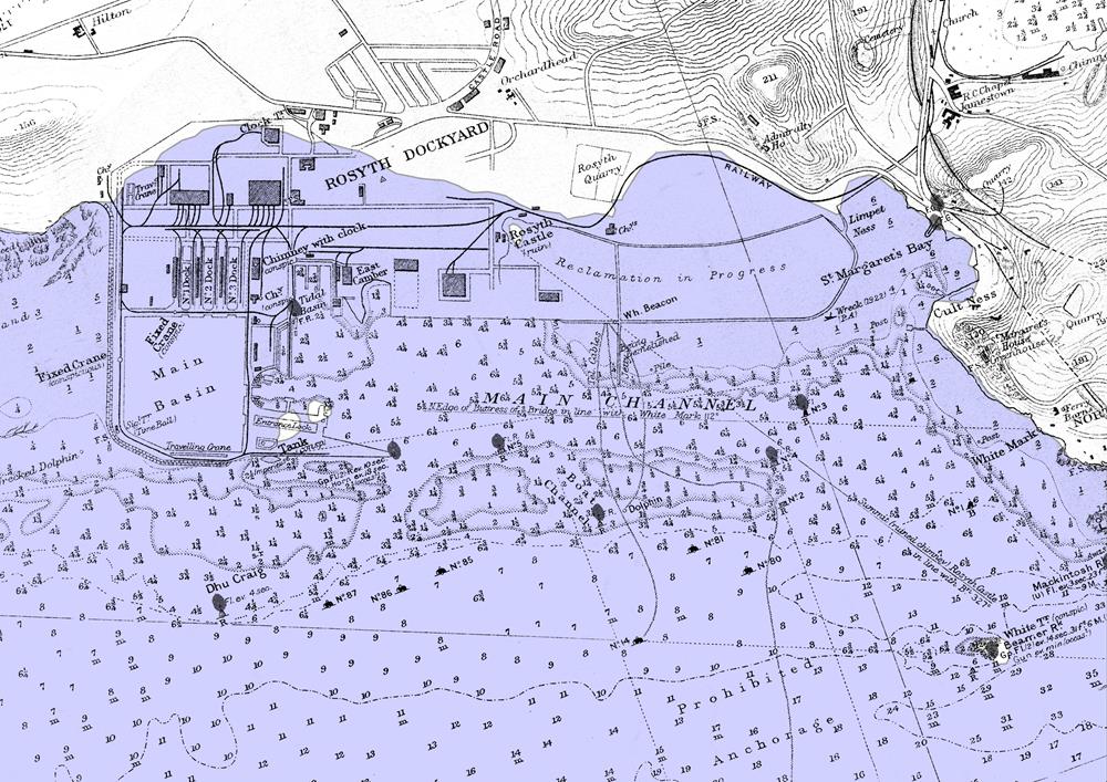
 Original high tide mark along the site of Rosyth Dockyard
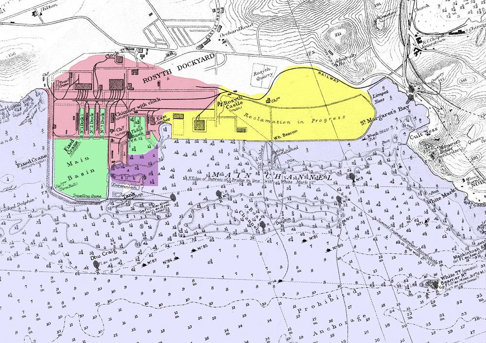
 Areas excavated (green) reclaimed with excavated material (pink) dredged as part of the main contract (violet) and reclaimed with dredged material (yellow)
The areas inside the main basin, and the submarine basin were excavated “in the dry” once water had been pumped out behind clay coffer dams. The material from these areas (shaded green in the diagram above) was used for land reclamation of the areas to the north of the main basin and the submarine basin (shaded pink in the diagram above).
This land was required for immediate use by the dockyard.
Dredging
Dredging work was divided into two parts.
The area in front of the submarine basin, and around the entrance locks was dredged as part of the main works contract. The material recovered from this area (shaded violet above) was used for land reclamation to the east of the submarine basin (shaded yellow). Most of this land was intended for future use by the dockyard.
The approach channel was dredged under a separate contract awarded to Messrs. Topham, Jones & Railton. Material from the approach channel was removed and deposited at sea.
Approximately 12 million cubic yards of material was dredged and either used for reclamation or deposited at sea. The materials comprised a top layer of mud, silt, and shells ranging from 5 to 10 feet in depth. Beneath this was a layer of gravel in which were embedded numbers of large glaciated boulders. Below the gravel was a deep bed of soft red clay extending far beneath the bed of the dredged channel.
Main contract dredging
Two bucket dredgers – “Venezia” and “Ireland” dredged material from the sea-bed and loaded it into barges. The barges were then towed to where land reclamation was taking place. Three suction reclamation dredgers “Wilkinson Nash”, “Edinburgh,” and “Belfast” pumped the spoil ashore from the dumb barges.
Banks were built in the neighbourhood of Rosyth Castle to form a series of ponds in which the dredged material settled after being pumped out of the barges. The surplus water escaped over weirs.
Much of the clay in the mix was turned to a fine slurry by the pumping process. The result was that stones and heavy material were deposited in the immediate vicinity of the discharge-pipe outlet, forming ridges of hard material across the reclaimed areas, whilst between these ridges and at the extremities of the ponds there were large areas filled with extremely soft slurry.
At the time when these arrangements were made it was not anticipated that these areas would be required for many years. Owing to the war, however, several of these slurry areas had to be utilized for naval purposes before the material had consolidated. An attempt to dry an area by drains leading into a well which was kept constantly pumped down was only successful after some years of operation. This, under the conditions then prevailing, was too slow to meet the requirements. The particles in the slurry retained their moisture even under favourable drainage conditions. In the absence of any rapid method of consolidating these areas they were covered with a blanket of dry material which sank into the soft material and in the worst places attained a thickness exceeding 10 feet.
All buildings on this pumped reclamation had to be carried on piled or pier foundations, whilst very great difficulties were, and have since been, experienced with roads, railways, drains, water-mains, etc., because the material under the blanket has remained soft.
(In 1926, Alexander Gibb (of Easton and Gibb) said that if he were responsible for dredging a similar place again, and had to fill a reclaimed area, he would never pump such material ashore, but would dump it at sea and excavate dry earth filling and tip it on the site. He thought if that had been done at Rosyth it would have been cheaper and would have given far better results.)
Approach channel dredging
The approach channels were dredged by the bucket dredgers “Gadsden”,“Merwede” and “Devon.” The spoil was taken to sea on six 600-ton steam hopper-barges, to be deposited in deep water between Oxcars and Inchcolm, 6 miles east of the works. After the outbreak of war this area was declared out of bounds so a deep depression around Beamer rock was used instead.
The approach channel was dredged to a depth of 45 ft (13.7m) below Ordnance datum. The depth of the channel to the emergency opening and of the berth along the south river wall was 32ft (9.75m) below Ordnance datum. The area in front of the submarine basin was dredged to 27ft (8.2m) below Ordnance datum.
| < 19 – Secondary floating caisson for the Emergency Opening | Δ Index | 21 – The Oil Storage Tank Farm > |
top of page
