5 – 1906 Surveying the site
| < 4 – 1903 Selecting a site | Δ Index | 6 – 1909 Awarding the construction contracts > |
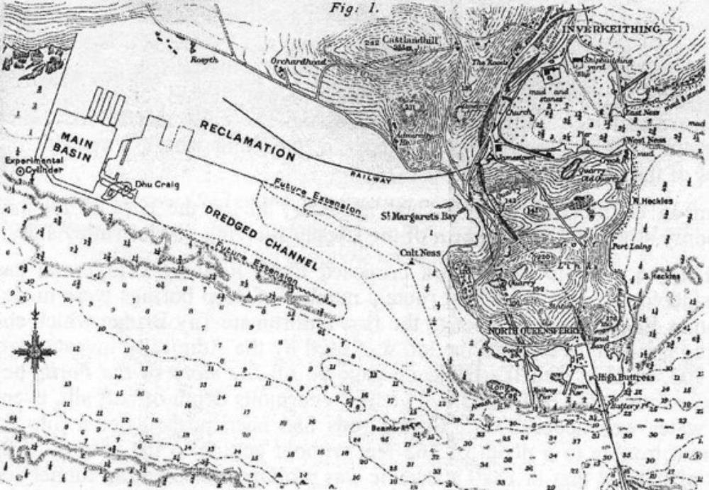
The site was covered with glacial deposits: silt sand and boulders with outcrops of bedrock (the Firth of Forth was scoured out by repeated glacier advances and retreats over several ice ages.). It was explored by sinking 208 boreholes, with some spots tested by sinking a cast-iron cylinder, 8 feet (2.4m) in diameter to depth of up to 101 feet (31 m) below the sea-bed.
 Location chart of 1912 showing the survey cylinder that revealed geological weaknesses at the south-west corner of the main basin. The chart also shows the potential extension to the east.
Modifying the design to suit local conditions
The survey cylinder showed that the planned south-west corner of the basin would be over a deep bed of sand. This corner of the basin was therefore cut off at an angle to avoid the sand and make construction easier and faster.
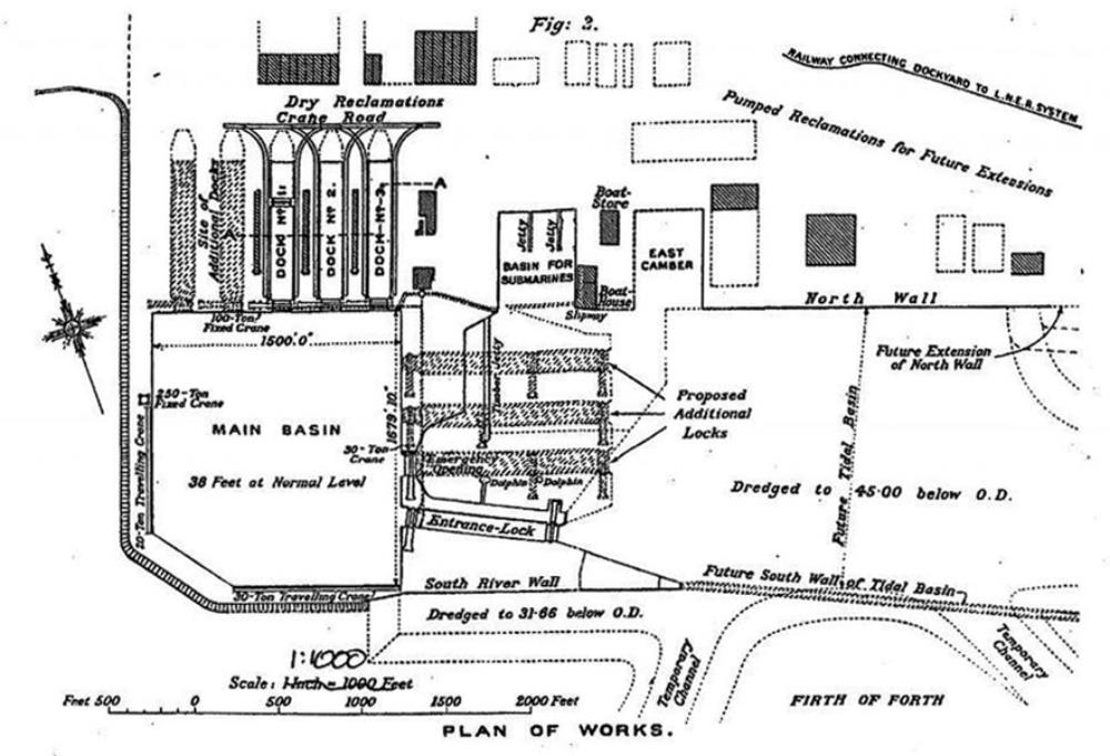
The basin was positioned so that the rocky outcrop of Dhu Craig would provide a solid foundation for the entrance lock. This lock maintains a constant water level in the inner basin, regardless of the state of the tide.
It was also decided to reposition the emergency entrance away from the difficult south-west corner to a new location adjacent to the main entrance, to increase the number of dry docks to three, and to eliminate the internal pier, as it would be a hindrance to the new generation of large Dreadnought battleships.
 Chart from 1926 showing the final layout, with No1 dock sub-dividable with a floating caisson, and proposed extensions including additional locks outside the main basin.
| < 4 – 1903 Selecting a site | Δ Index | 6 – 1909 Awarding the construction contracts > |
top of page
